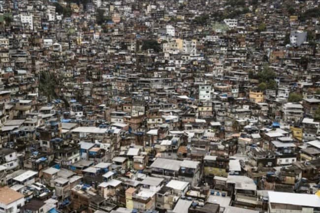
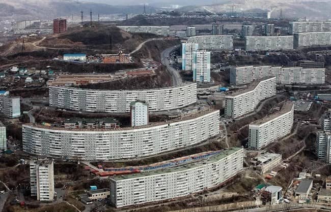
The city was supposed to be the idea. The concentrated, walkable, culturally dense answer to how a lot of people could share a limited amount of space in a way that worked for most of them. This gallery documents what happened instead, or rather, what happened in the specific cases where the idea was handed to people who misread it, optimized for the wrong variable, or simply kept building until something went wrong that could not be unbult. Urban hellscape is not a technical planning term. It is the correct description for a place where the built environment has won the argument against every other consideration, and the photographs are the evidence submitted to the appeal.


Urban hellscape
Read More
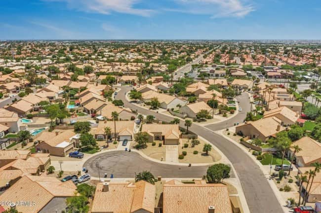
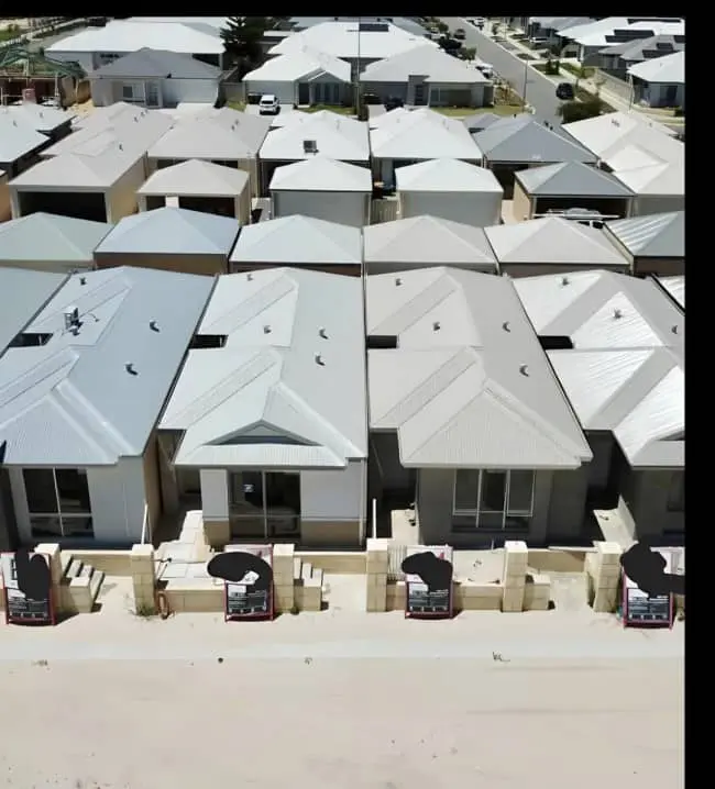
Suburban sprawl photography has a specific quality that architectural critics call “self-indicting,” which means the image does not need a caption to make its point because the point is the image. The Arizona subdivision aerial is this quality at maximum concentration. Beige houses extend to the frame’s edge in every direction. The streets curve in the manner of streets designed by software that prioritized traffic flow over navigation. There are no sidewalks because there is nowhere to walk to. The houses are identical at a level of precision that suggests the variety of human experience they contain is entirely interior, invisible from above, and unacknowledged by the architecture surrounding it. The Australian version occupies the same register with different vegetation and the same absence of green space, soul, or distinguishing features that would allow a resident to locate their specific house from a moderate altitude.
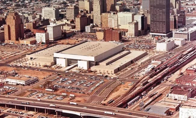
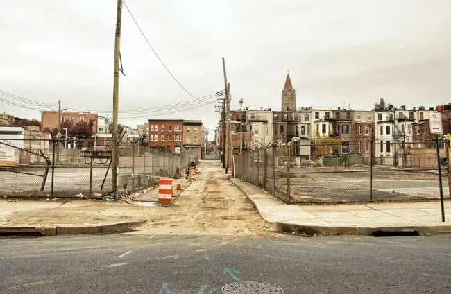
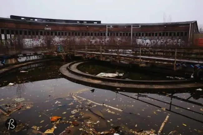
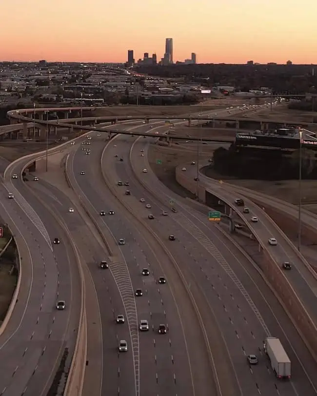
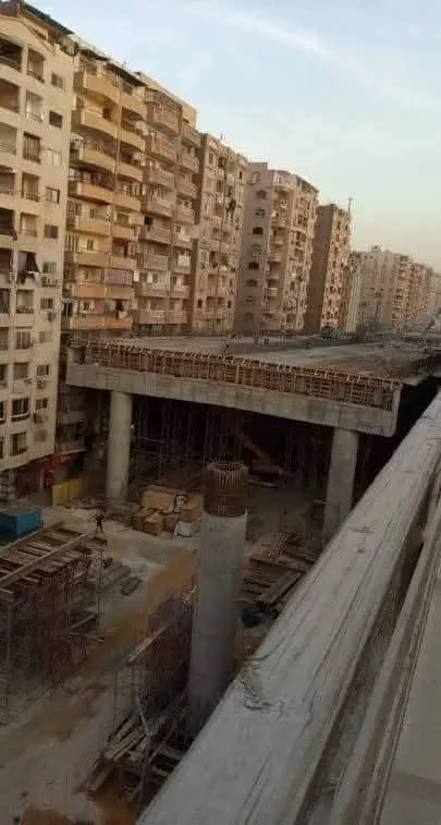
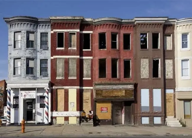
Bad city planning examples cluster in this gallery around the category of infrastructure that replaced the thing it was meant to serve. The downtown aerial with the convention center surrounded entirely by surface parking lots and elevated highway infrastructure is the clearest example: a building designed to bring people to a place, surrounded by a moat of car storage that ensures the place has nothing to offer anyone who arrives on foot. The street-level blight image is the longer-term outcome of the same decisions applied at the neighborhood scale. Chain-link fencing, orange construction barriers, and decaying rowhouses are the residue of a planning process that prioritized removal over replacement and left the gap in place for long enough that the gap became the neighborhood.
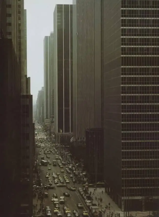
The smog canyon image is historically important as documentation of what the city looked like before anyone decided the air situation required intervention. Brutalist glass skyscrapers, bumper-to-bumper traffic at street level, and a visibility ceiling that suggests the sky has been replaced by something else entirely: this is the urban environment at its most confident that density and prosperity were the same thing, and the air quality is the footnote that was eventually addressed and should not be forgotten.
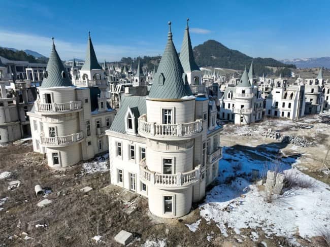
Failed urban development in the international category includes Turkey’s Burj Al Babas, which is an entry that requires no additional exaggeration because the facts of the situation already contain all of the comedy available. A developer built hundreds of identical mini-castles on a Turkish hillside as a luxury housing development. The development encountered financial difficulties before residents arrived. The castles remain, empty, turret-complete, in a field that has become one of the most visited examples of ambitious real estate optimism and its consequences. The castles are not haunted. They have simply never been occupied. The distinction is meaningful and is also, somehow, worse.
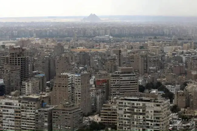
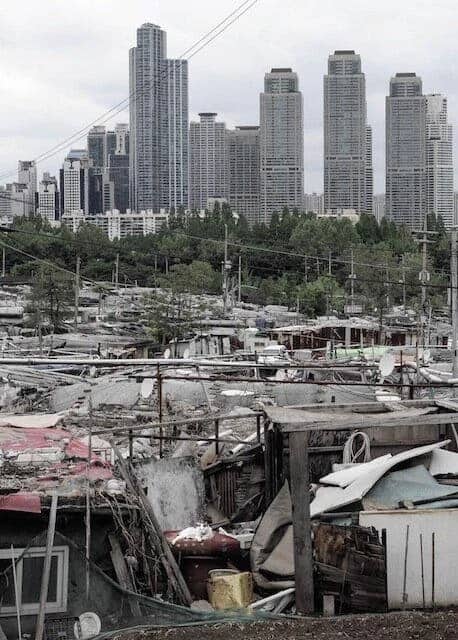
Cairo’s pyramid view, reduced to a faint geometric suggestion through the haze of one of the world’s largest and fastest-growing urban agglomerations, is the gallery’s most genuinely melancholy image, because it is the only one that involves something that was built to last forever being slowly erased from visibility by something that was built yesterday and has not yet been addressed. The pyramids are still there. The photograph confirms this. The photograph also confirms that “still there” and “visible” are no longer guaranteed to mean the same thing in the same city.
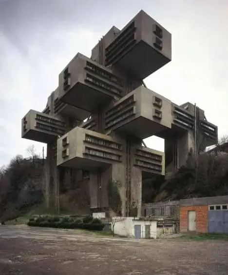
If this gallery has sent you to an architecture or urban planning research trail, brutalist architecture photography is a rich companion category that documents the built environment with the same mix of critique and grudging appreciation. Urban planning fails broadly cover the full policy history behind the images here, with more context and fewer jokes. And for anyone who found the abandoned development images most compelling, ghost town and failed real estate photography is an endlessly populated space where the ambition and the outcome are always in conversation.
Read Memes
Get Paid

Jake Parker, known around the web as "Jay," is a digital writer with over 10 years of experience covering internet humor, meme trends, and viral content. Before joining Thunder Dungeon, Jay was the lead editor at MemeWire, where he helped curate memes that broke the internet, including coverage on trends like Distracted Boyfriend, Kombucha Girl, and Bernie Sanders’ Mittens. A self-proclaimed "professional procrastinator," Jay spends his downtime scrolling Reddit and Twitter to stay ahead of what's about to break the internet next.